bout de papier, Vol. 21, No. 1 (2004) — Fall/Winter 2004 // Automne/Hiver 2004, pp. 9–14
Imagine a Mediterranean country with sandy beaches, well preserved classical ruins, cultural diversity, a good infrastructure, moderate prices and fine sunny weather. It is a safe and generally pleasant place for the relatively few visitors who make it there. Additionally, the country remains a somewhat exotic, “nouveau” destination in comparison to its neighbours.
On the other hand hope to ne gained a reputation of being somewhat controversial on the world stage. Welcome to the Great Socialist People’s Libyan Arab Jamahiriya. For a real rather than an armchair traveller, however, it would be more accurate to say a visitor receives a cautious welcome to the Jamahiriya. The term Jamahiriya translates roughly in Arabic to “state of the masses.” It has officially been incorporated into the name of the country since March 1977. Physical access to the country has eased with the reestablishment of direct air services to Tripoli, following many years of sanctions in the 1990s. Yet obtaining visas for independent travel there is still not straightforward or easy. With Libya’s recent rehabilitation on the international stage, this may become less onerous in the future. However, one of the great advantages of a life in the foreign service is occasionally having friends posted in exotic locales who might be able to help out. Thanks to Ambassador David Viveash’s generosity and efforts, I found myself “inside the Jamahiriya” with a chance to visit some of the country.
Libya has been able to combine its relatively low population (5.5 million) and high petroleum exports into a comparatively good standard of living for most of its citizens, while avoiding many of the obvious consumer excesses which one sees in a number of the Gulf states. Libya’s oil wealth has been a magnet for nationals from other poorer countries, such as Sudan and Niger, who are a visible presence in Tripoli. Many work as wage labourers or servants and otherwise perform tasks that more prosperous Libyans are now unwilling to do.
Despite the influx of oil money on a large scale, prices in Libya are reasonable for someone arriving from Europe or North America. This is most convincingly, if not surprisingly, demonstrated at the gas pumps where unleaded gasoline sells for the equivalent of 11 Canadian cents per litre. Even at this price, the gasoline is still being sold inside the country at a healthy profit. Three decades of relatively high petroleum prices, particularly given the very low production costs, have also allowed the country to construct and develop an excellent infrastructure. Tripoli, the largest urban centre, with a population of more than one million, is a prosperous-looking city of white and green on the southern shores of the Mediterranean. Money has been lavished on some architectural monuments in the city, most notably the Jamahiriya Museum. It has one important archaeological building dating back to Roman antiquity, the Arch of Marcus Aurelius, not far from Green Square, the unofficial centre of the city.
In my experience, Libya was one of the most welcoming and interpersonally pleasant places I have visited in the Arab world. This somewhat reserved, but genuine, courtesy to foreigners is well known to others who have visited the country. However, friends back home were sometimes surprised to hear this, particularly given Libya’s erstwhile reputation combined with the somewhat overheated threat rhetoric in the western media since the cataclysmic events of 9/11. There was a palpable sense from many of those I talked to inside the country that Libya has been unfairly and inaccurately portrayed in the Western media.
This calmness and courtesy was particularly noticeable as I wandered through the covered medina within Tripoli. While it is considerably smaller than its equivalent in cities in, say, Morocco, it was also a delight to wander through it in a relaxed environment without touts, bargaining or pressure from merchants to buy things. A good thing too, as the handicrafts on display were limited and there / was i was little that struck me as interesting to purchase. My only real concern about personal security in Libya, one not to be taken lightly, related to the rather chaotic and aggressive patterns of driving. This was particularly true in Tripoli and along the coastal corridor heading towards the Tunisian border. Travelling in the interior of the country is less intimidating as there is comparatively little traffic once one gets beyond the urban centres and coastal routes.
The other notable drawback is the littering and garbage that one finds throughout Libya, including in the precious ruins of UNESCO World Heritage sites.
The country is well connected through telecommunications and the use of the Internet is widespread, as indicated by the ubiquitous signs of the Internet Explorer logo outside many small buildings and shops. Access to the web is inexpensive at under $1 per hour. There are, however, some variations on access which take into account local circumstances. A sign at one of the Internet points in Gharyan, a city 100 kilometres south of Tripoli, noted succinctly “Browsing of political and pornography strictly prohibited.”
I I was interested in three travel objectives beyond Tripoli. The first objective was to visit the famous Roman ruins of Leptis Magna and Sabratha. Those two settlements, along with Oea (now subsumed in present-day Tripoli), formed Tripolis (Latin for three cities), later to become Tripolitania province in the Roman Empire. The second objective was to explore the Berber architecture in some villages in the Jebel Nafusa mountain range between Tripoli and the Tunisian border. The third was to get some access to the desert and in particular to visit “the Pearl of the Sahara,” the ancient oasis of Ghadames.
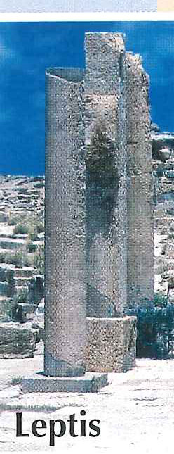
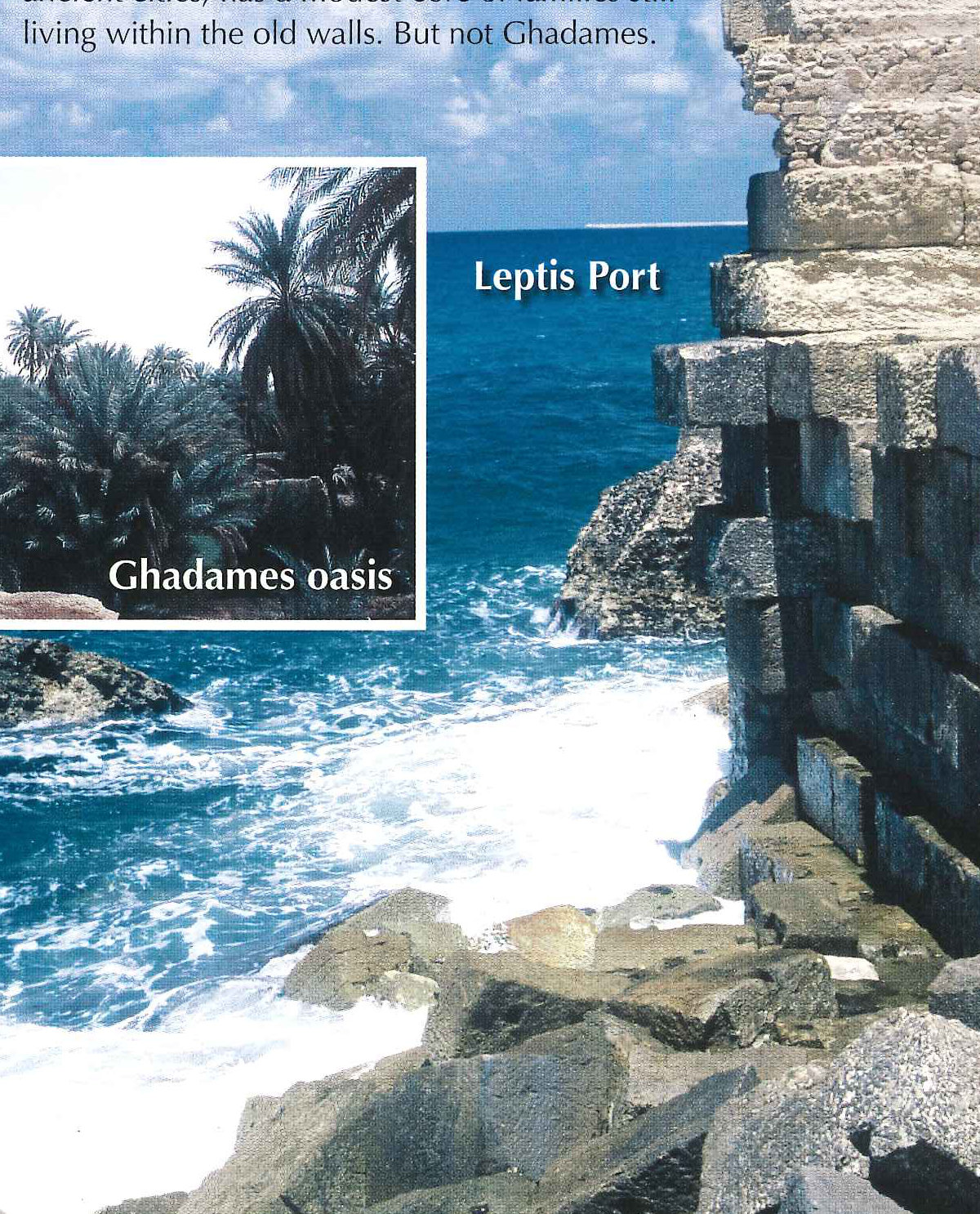
The Roman ruins of Leptis Magna are among the most impressive archaeological sites in the world. The ruins are located about 130 kilometres to the east of Tripoli. The smaller but still interesting site of Sabratha is 80 kilometres to the west. Both are scenically situated right on the coast of the Mediterranean Sea. The scale of the Roman ruins at Leptis Magna is extraordinary. The city was founded during Phoenician times around 1000 BC. Later it fell under Carthaginian control until it was taken over as part of the Roman Empire in 23 BC. Late in the first century BC a quarry was opened at Rasel-Hamman, south of Leptis Magna, that yielded an exceptionally hard limestone used to build most of the town’s later structures.
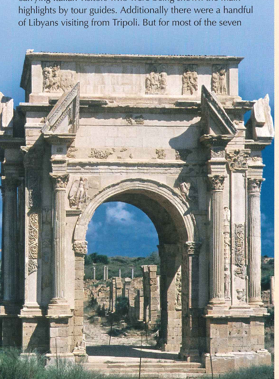
Leptis Magna reached its zenith in the second century AD when native son Septimius Severus ascended to become Emperor of the Roman Empire. Septimius Severus honoured his place of birth by funding an ambitious building program that included a magnificent new Forum and a richly decorated four-way arch marking the intersection of the city’s two main streets. Major construction started in AD 193 and continued for almost two decades. During its era of glory, Leptis Magna may have had as many as 80,000 inhabitants. The town also had a steady base of income from the slave trade, gold and ivory, as well as agriculture, which would have been considerably richer in those days. Its decline began with a devastating earthquake in 365, and accelerated with the disintegration of the Roman Empire in the fifth century. It fell under the influence of the Vandals and by AD 534 it was part of the Byzantine Empire. By the time the Arabs came to control the region in 642, the city was almost empty. Within another century it was abandoned completely.
The excavations which resulted in the restoration of Leptis Magna were done largely during the most recent period of Italian colonization from the aftermath of World War I until the 1940s. The Italian dictator Benito Mussolini was eager to prove that Libya was historically part of Rome. Thus he poured great energy and resources into excavating and preserving the Roman sites, whereas suspected earlier Phoenician sites were bypassed and remain scantily explored to this day.
The remains have attracted far less attention than they deserve. For the time being, one of the greatest archaeological sites in the world is almost devoid of tourists and visitors. Leptis Magna was declared a UNESCO World Heritage Site in 1982 and some additional work is being done to restore the site even further.
When I arrived at Leptis there were a couple of tour buses hours I spent at Leptis, especially beyond the central sites, I was wandering through the extensive ruins alone. The hard limestone, lack of a nearby urban centre and dry semi-desert conditions have allowed the ruins to remain in a far better state of preservation than most Roman ruins found elsewhere in the Mediterranean. Even the excavations to date have not revealed all of the wonders of Leptis. The Amphitheatre and the Forum are located a couple of kilometres beyond the main set of ruins, virtually in isolation. I walked along a road to the east, ultimately reaching the point where the road is blocked by a fence. There were a couple of Libyans working nearby on a broken down vehicle. They pointed to a hole in the fence a few hundred metres away where I walked through, and then I continued on to the Forum and Amphitheatre. The scale of the abandoned Amphitheatre in the isolated fenced off zone was not much smaller than the Coliseum in Rome. One can see extensive evidence of ruins that have yet to be fully excavated. It will take decades to completely unveil the magic and mystery of this most splendid of archaeological sites.
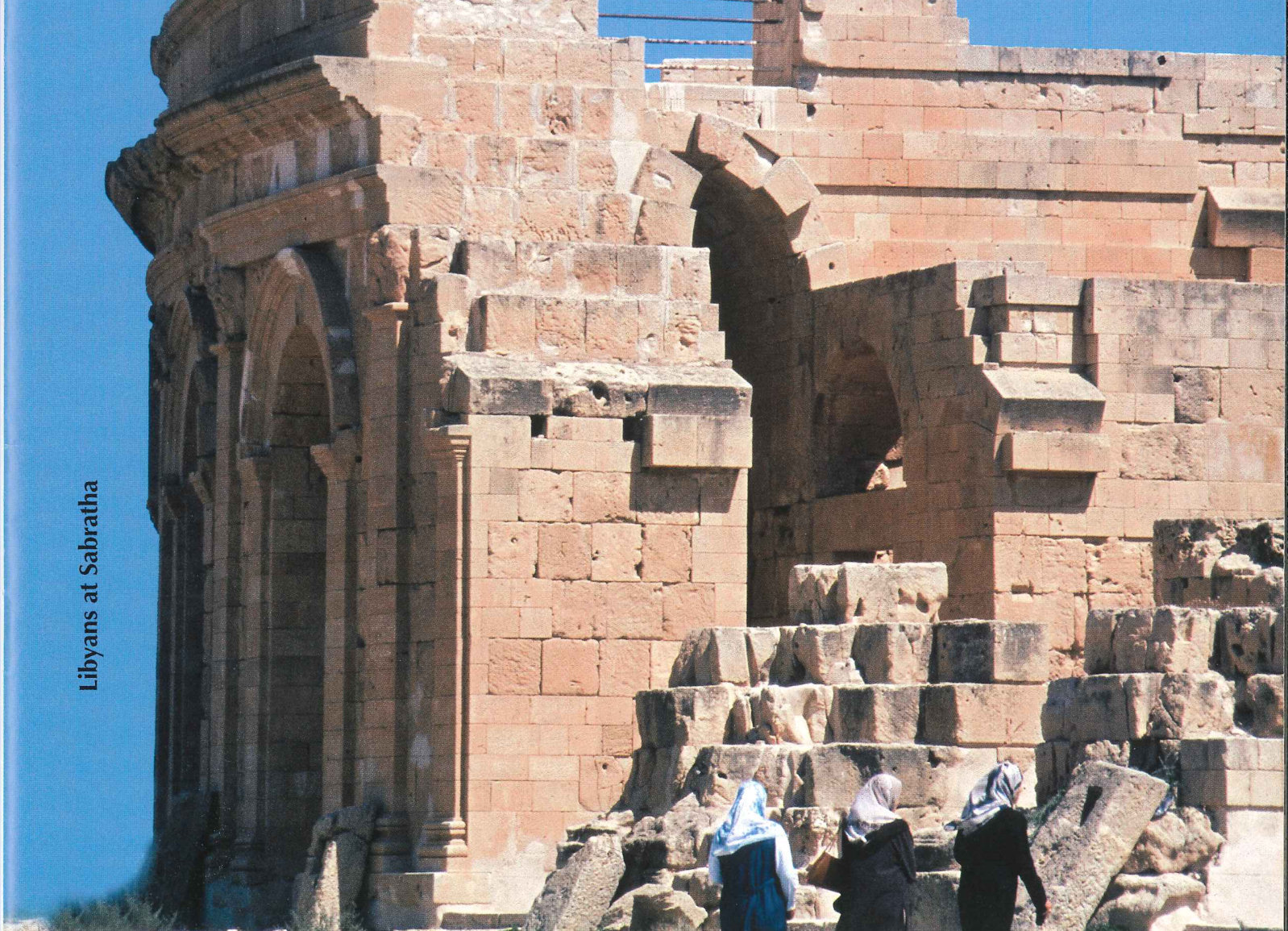
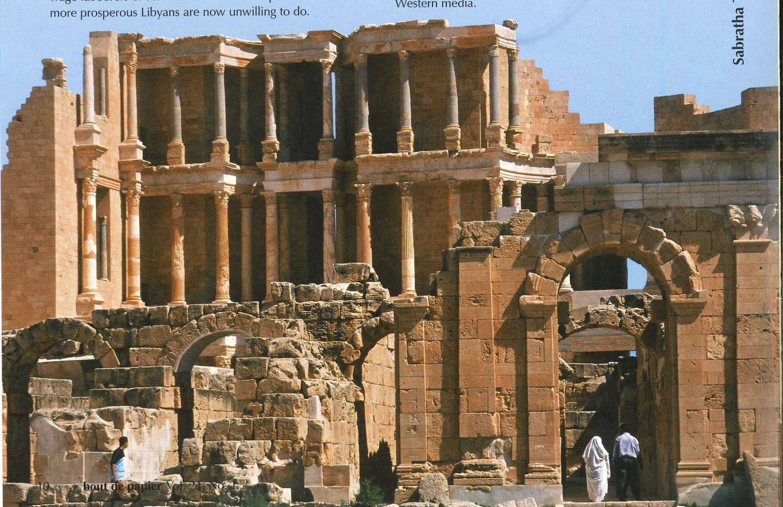
Sabratha, while smaller in scale, has, if anything, an even more beguiling setting right at the edge of the Mediterranean Sea with small sandy beaches on either side of the main ruins. Like Leptis, Sabratha began as a settlement to service the coastal trade of the Carthaginians. It was developed as a permanent site in the fourth century BC to act as a terminal for the trans-Sahara trade, since it had a natural harbour on an otherwise long and unindented coastline. It was shaped by the Romans after the destruction of Carthage in 146 BC and remained so until the Vandals took over in AD 455. Sabratha was retaken by the Byzantine Empire in AD 533. Finally the town was taken by the Arab conquest of North Africa, but it continued to prosper under them until AD 748 when trade moved to Tripoli and the town began to lose its importance and finally was left abandoned.
Many of the buildings in Sabratha were made from sandstone, and thus have not proven as durable as the limestone structures at Leptis Magna. The Theatre, reconstructed in the 1960s, is its main showpiece. Also notable are the columns of the Temple of Isis, virtually at the Mediterranean shoreline. The ruins are significantly more modest, both in size and in their state of preservation in comparison to Leptis. Once again, there were only a handful of Libyans visiting the site. Having the opportunity to spend a few hours in solitude amidst these ruins also counts as one of the highlights of a visit to Libya.
South and west of Tripoli is a low-rise mountain range, the Jebel Nafusa. The population density in this area remains relatively high. While dry, it receives just enough rainfall to have vegetation and some agriculture. There are numerous traditional villages throughout the various parts of the escarpment. It is the home to a series of ancient Berber settlements, including Qasr El Haj, Nalut, Kabaw and Tormeisa.
There are two main roads to Ghadames crossing the Jebel Nafusa. On the way there, I travelled along the coastal road towards Tunisia. Not too far from the Tunisian border is a side road which then heads in a southerly direction towards the mountains at Nalut. Qasr El Haj is located a few kilometres off this road. On the way back, I took another route which travels along the top of the escarpment from where Kabaw and Tormeisa are more easily visited, before reaching the urban centre of Gharyan, 100 kilometres to the south of Tripoli. From Gharyan, a significant city of over 100,000, one descends off the escarpment down to the coastal plain and back to Tripoli.
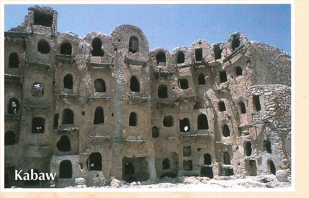
There are a handful of abandoned granaries in some of the communities. They bear a similarity to grain storage sites in nearby Tunisia, in particular Metameur and Medenine. Berber grain storage sites, though usually relatively modest in size, are among the more otherworldly of architectural sites. They have been described as resembling high-rise apartment blocks for desert gnomes. They are now unused storehouses where rural families previously kept their stocks of wheat and oil under communal security arrangements. The storerooms, some of which are more than 800 years old, were used until recent decades. Large pieces of old pottery for keeping oil and a variety of old farm work implements lie where they were abandoned. The grain sites are usually kept under lock and key by one of the villagers. Usually, you have to ask around town to find the holder of the keys. Once located, the villager sells you a ticket and unlocks the entrance. Beyond that you can wander around the abandoned granaries at will. Qasr El Haj, Nalut and Kabaw each had their own distinctive granaries. Tormeisa is an abandoned Berber village perched at the edge of a high plateau from which the eastern beginnings of the Atlas mountains plunge steeply toward the coastal plain. The edge of the escarpment is probably at its most spectacular at this point. It has a very modest granary.
As one heads to the southern edge of Jebel Nafusa range, the already drying scenery starts looking ever more like the entrance to the Sahara proper. The population diminishes, sheep and goats are eventually replaced with occasional groups of camels and the scrub vegetation dwindles down until there is virtually nothing left but rocks and sand. We drove south through flatter topography beyond Sinoun, then on to the settlement of Derj. From Derj we continued west to Ghadames. The road is paved all the way to Ghadames, although in some of the later stages, shifting sand dunes have drifted onto the main road. The Algerian border is less than twenty kilometres to the west of Ghadames. The southernmost point of Tunisia is also close by and would be approximately thirty kilometres further north. By the latter part of May when I was visiting, temperatures in the desert were climbing into the high 30s and a light pinkish haze enveloped the desert sky throughout the day.
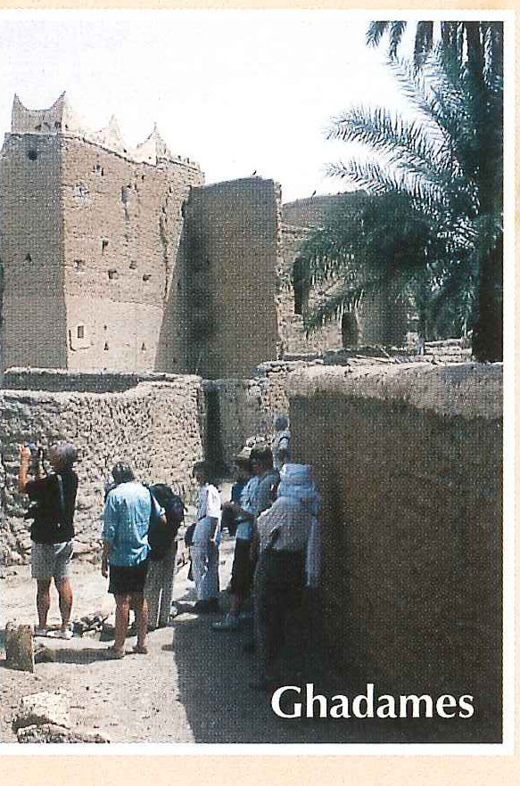
I I had long been fascinated by Ghadames. My interest was initially piqued by an elderly British traveller in the early 1980s when I was visiting nearby Tunisia. He described Ghadames as the pearl of the Sahara, the ultimate dreamlike desert oasis. It was one of the Sahara’s most prosperous and important locations, an entrepôt between Europe and great trading towns of the Sahel, such as Timbuktu and Kano. Ghadames was famous additionally for the trading acumen of the inhabitants and the creativity of its residents in constructing an oasis with unique and fascinating architecture replete with cool labyrinthine alleyways that kept temperatures within the old city much cooler than the surrounding desert. Many of the social customs have changed little over the centuries. The 1911 Encyclopaedia Britannica described how as many as 30,000 camels would pass through in caravans on an annual basis, in its heyday in the early to middle nineteenth century. Later, with the drying up of the slave trade and with the development of more efficient trade routes from major centres such as Kano to ports along the Gulf of Guinea, the overland trade through the Sahara became less important and Ghadames faded over time.
I I personally found the visit to Ghadames, however, to be an oddly bizarre and disjunctive experience. In almost all other places I have visited in which modernization has changed historic towns in recent years, whether Fez, Lhasa, Bokhara, Hanoi or Jaisalmer, people continue to live in the old town, while the population expands in a modern town beyond the traditional town centre. Even Khiva, in Uzbekistan, perhaps the most transformed and sanitized of ancient cities, has a modest core of families still living within the old walls. But not Ghadames.
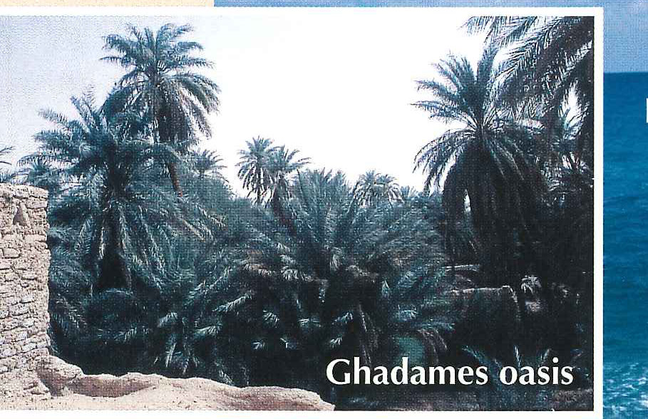
The final demise of old Ghadames was based not on the ill fortune of a decline in trade. It was the result of a direct decision to increase the quality of life of its citizens with some of the resources of the state deployed from the flush of oil money revenues. Putting aside my own romantic dream of wandering through colourful and exotic locales, one can understand the rationale of a self-styled socially progressive society with lots of money deciding to invest it in giving desert dwellers modern homes with air-conditioning, satellite dishes, wide streets and a magnificent new mosque.
Old Ghadames is today a ghost town, whose resident population dropped from approximately 7000 in the late 1970s to zero today. It was progressively abandoned in the early 1980s with the transfer of the entire population. I was told that one family stubbornly continued to reside in the old city for many years after all other had left, despite having an apartment block available in the new town. They were finally persuaded to leave a couple of years ago.
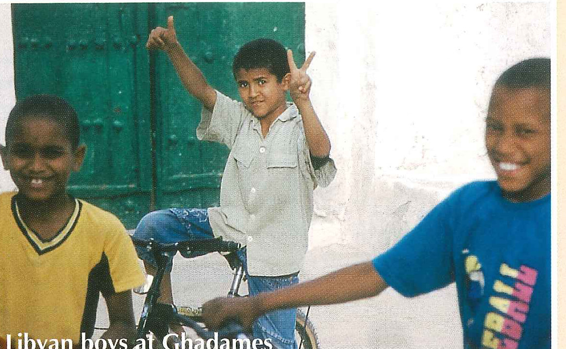
In the afternoon and evening one can occasionally see citizens bicycling through parts of the old town, chatting in small groups of two or three in the cool alcoves or tending to some crops in parts of the old town. Citizens still officially have title to their old homes and plots of land. Old Ghadames was declared a UNESCO world heritage site in 1986. Little work was done during the period of sanctions, but over the past five years the United Nations Development Program has been involved in some conservation and preservation work. There is a museum and a modestly growing tourism traffic which will probably result in the preservation of the most important parts of old Ghadames. Nevertheless, the gradual disintegration of the outskirts and the effects of decay and neglect of the less central parts of the town is clearly visible as well. The abandonment of parts of the town to the elements while preserving some of the core parts of the town is a process that will almost certainly continue, and a visit to old Ghadames now is a very different experience than it would have been had I been able to visit in the early 1980s. I spent a couple of evenings in modern Ghadames. I would have dinner at roadside stalls serving barbecued mutton brochettes and alcohol-free beer. Locals enjoy watching sports programs on television or walking into stores selling the now universal bric-a-brac exported from southern China. Motorcycles, trucks and cars would occasionally drive by, stirring up the dusty streets with a combination of particulate matter and diesel. The latest Arabic music blared from competing open-air restaurants, significantly ratcheting up the ambient background noise in the warm desert night.
But when I headed back to the old town again in the late evening, the modern sounds faded away. Looking skyward I could see the emergence of the panoply of stars. I could also see the silhouette of palm trees and minarets rising above the tightly bound labyrinth of the town walls and got a sense of primeval timelessness — of an era where camel caravans arrived in Ghadames, the pearl of the desert, having made the long and perilous trek across the silent wastes of the
View the original scanned pages →
Originally published in bout de papier, Vol. 21, No. 1 (2004) — Fall/Winter 2004 // Automne/Hiver 2004, pp. 9–14. Read the rest of this issue →