bout de papier, Vol. 7, No. 1 (1989), pp. 22–25
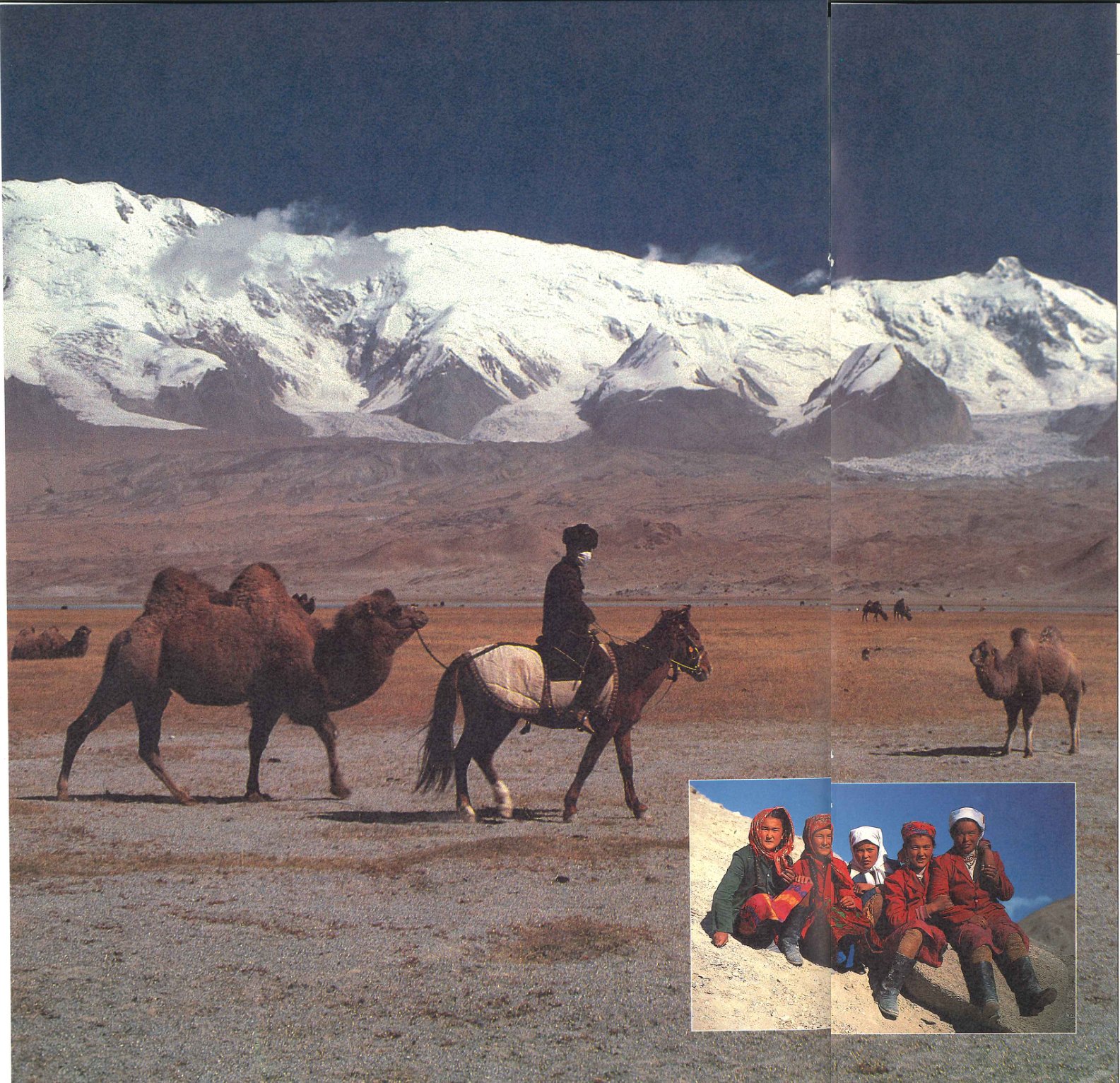
In May 1986, the governments of Pakistan and China announced the opening to foreign nationals of the Karakorum Highway over the Khunjerab Pass. At an altitude of 16,000 feet, the Khunjerab is reportedly the highest paved mountain crossing in the world. Its opening unlocked the back door to China and re-established the long closed link of the legendary “Silk Road” through the Karakorum and Pamir ranges between the Indian subcontinent and Kashgar, the regional capital of what was once known as Chinese Turkestan. Today, Kashgar is the major trading centre of southwest Xinjiang Province, although the Silk Route through the Soviet Union is no more.
The Karakorum Highway was blasted up the Indus Valley and its tributary, the Hunza, by Chinese and Pakistani army engineers in the 1970’s. It was built as a military road to provide direct access for Pakistan to its close ally, the Peoples’ Republic, and to this day is maintained by the Pakistan Army. Apart from its strategic value, the highway quickly helped bring about the economic development of Pakistan’s Northern Areas-Gilgit, Skardu and Hunza – which had been cut off from the rest of the country since Partition, except for an air link. With the opening of the highway, foreigners were allowed to travel as far north as Hunza, but beyond the Baturo Glacier, some 100 km. From the Chinese frontier, the road was blocked. Even if they somehow bypassed the checkpoint, they could not enter China.
Apart from military transport, the only use of the border crossing was an annual trade caravan of heavy trucks sent each year to Kashgar by Gilgit merchants. As a result, the bazaars of Gilgit were stocked with Chinese goods which made the forbidden border all the more tantalizing.
All this was about the change. The first foreigners to reach Pakistan over the Khunjerab were a group of foreign journalists resident in Beijing who participated in an excursion organized by the Chinese Government to publicize the route. However, I wanted to see what it would be like going over from the Pakistani side, and particularly what it would be like for a traveller on a shoestring budget. With the opening of yet one more “last frontier”, we expected that young Canadians would join other nationalities in seeking adventure, and we wanted to be able to anticipate any consular problems at the Embassy and be able to provide sound advice.
It was with this goal in mind that, with a colleague from the Embassy, Ken Pearson, I set out from Islamabad for China on May 29, 1986. In two days of hard driving, we reached the hamlet of Gulmit in the upper Hunza valley, the last place in Pakistan to offer overnight accommodation. Hunza, a former princely state allegedly ruled by the same family for more than 900 years, marked the furthest point of tourist penetration and several rudimentary but comfortable inns had been established by enterprising locals. The Hunzakuts, as the locals are called, are an unusual race, left behind in their mountain valley as waves of invaders swept over the subcontinent. They speak a language akin to no other in the subcontinent and many of the people have light or russet hair and blue eyes, attesting to their Caucasian origins. Today, they are Shia Muslims of the Ismaili sect.
The prince, or Mir, still resides sn karimabad the capital but although he still wields a great deal of influence, he no longer has any legal authority over the people. The ancient seat of the principality, Baltit Castle, built by Tibetan craftsmen in the 14th Century still looms over the valley. Today, the Mir lives in a more modern residence, where he regularly entertains bout de papier Vol.
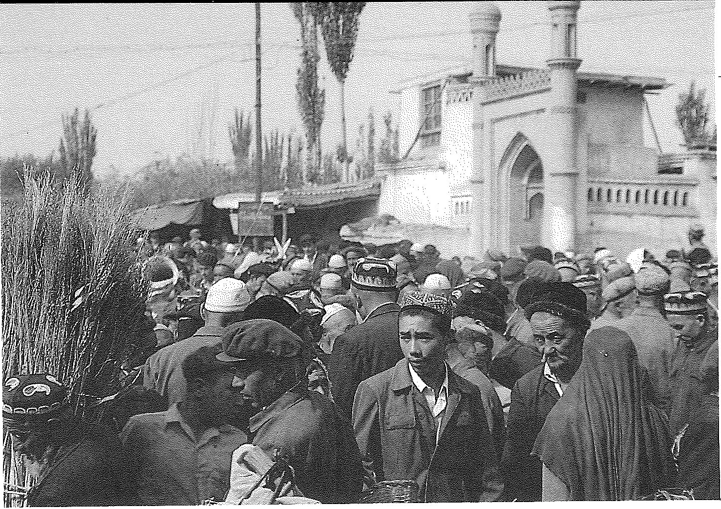
Sunday Market, Kashgar visitors. He is no stranger to Canadians as Canada has provided funding for a number of local development projects through the Aga Khan Foundation, and several Canadians (including the writer) are entered in the Mir’s guest book. This is a fascinating document dating back to the early 1900’s. Among the earliest entries is that of the first British Consul-General to Kashgar who passed this way in 1906 enroute to take up his post. At that time, and until the building of the highway in the 1970’s, the only route into Hunza and on over the Khunjerab was a single file donkey track. The remains of it, carved out of the sheer rock face or in places suspended over the gorge below, can still be seen.
The economy of Hunza is sustained by a series of irrigation channels that start high in the mountains at the foot of the glaciers. These channles, which are the community’s lifeline and are maintained by group effort, bring the glacial melt to terraced fields perched high above the course of the Hunza River. Although there is water in abundance in the river, there is no means to raise it to the fields high on the benches and for the most part the Hunza runs through a barren and desolate moonscape. Only where man has changed nature’s course can one see splashes of green marking the apricot groves and fields of wheat which are the staple of the economy.
But Hunza, fascinating as it was, was not our destination. On the morning of May 31, we left Gulmit and drove about an hour up the road to the Pakistani check point of Sost. Although Sost was about 50 km from the border, it was the last settlement before the pass and was where Pakistan had erected an improvised border control station. This was as far as we were allowed to take our vehicle and where the real unknown began.
We had heard reports that a Pakistani bus ran over the pass into China, but no-one in 24 bout de papier Vol.
Islamabad or Gilgit seemed capable of confirming this or supplying any details. We were about to find out. After parking our Landcruiser behind the police post, and clearing immigration at a makeshift counter, we spotted the bus. It was a shiny new Bedford bedecked in the usual Pakistani way with reflectors, paintings, icons and what-have-you. We were assured it would leave promptly at 9:00 am, so we paid our 50 rupees (5 dollars) and climbed aboard Sure enough, promptly at 9:00, the driver climbed aboard, cranked it up and we lurched about 50 metres down the road where we came to a sudden stop. There we waited about an hour and a half while boxes were loaded aboard, people milled about, and heated arguments were held over who-knows-what.
Finally we were off, following the banks of the Hunza River as it got narrower and narrower until it became a stream issuing from a snowbank. At this point, the road climbed up a series of steep switchbacks until we reached “Khunjerab Top”, a small barren plateau surrounded by high peaks and populated by marmots. There is a cairn at the pass, in English and Chinese, marking the frontier and here, technically, one switches from the left hand side of the road to the right. Our driver squatted in the centre all the way up and all the way down, so it didn’t much matter.
We piled out of the bus and caught our breath in the thin air. After several minutes a couple of Chinese soldiers appeared to take part in the ritual photos at the summit and then climbed aboard for a lift back to their post a half mile or so down the road.
The ride down to Pirali, the Chinese border post about an hour’s drive away, gave me a chance to observe our fellow passengers. The bus was packed and except for we two Canadians, all were Pakistani.
They were all small merchants on their way to trade in Kashgar and the back and roof of the bus was packed with a variety of western consumer goods to be exchanged for chinaware and textiles.
At Pirali, we parted company with the Pakistani bus which dropped us and returned empty whence it had come. We faced more uncertainty. Again there had been rumours that Pirali was served by a Chinese bus, but we had been unable to confirm this. Still, we reasoned that our Pakistani fellow travellers had to know what they were doing and we would just follow them. After clearing immigration control we waited and sure enough after an hour or so the most decrepit had broken down. I brushed off the Mandarin I had scarcely used since leaving Beijing 6 years earlier and ascertained that for 20 yuan (10 dollars), we would buy a one way ticket to Kashgar, a day and a half’s drive away. We would spend the night in Tashkurgan, the closest (and only) town.
Despite the decrepitude of the bus, I came to admire its resilience as we hammered over the bone-jarring road. Any pretence of pavement had disappeared just over the border. About an hour from Pirali, we saw our first sign of human habitation other than the official and military presence at the border. A lone yurt, a round tent made of skins, stood out on the barren plain while all around the snowclad Pamirs towered in the setting sun. We were still at over 13,000 feet and the peaks around us were all over 20,000. Apart from the yurt and a couple of yaks which obviously belonged to the Tadjik nomad family camped there, the countryside was totally barren-not a tree, not a shrub, barely a blade of grass. Unlike on the Pakistani side where we had approached the pass up a steep defile, once into China we found ourselves on a high open rolling plain, surrouned by mountains on three sides but which opened up ahead of us in a slow descent to the desert. It truly gave one the sensation of being on the roof of the world.
Tashkurgan, where we spent the night in a new but unfinished guest house, is the administrative centre of the Tadjik minority autonomous county. There were almost no ethnic Chinese and those that we saw gave the distinct impression that they knew they had been banished to the furthest reaches of the realm. The next morning, after a thoroughly disgusting breakfast of rock-hard bread, salty dishwater (which we were assured was tea and cold pickled cabbage, we remounted our bus for the next 12 hour i. I leg of the journey.
At first, we passed road-gangs, apparently prisoners, and large groups toiling on land reclamation. At times the road completely disappeared and we struck off across open country. We passed groups of tombs, small dome like structures made of baked mud. They could have been a century old or a week old, it was impossible to tell. After a while, all signs of civilization disappeared and we rattled across a vast empty basin. As I started thinking of lunch, we came to a halt before a small compound in the middle of nowhere that seemed to be some kind of a staging post for the bus line. We gratefully piled out. A couple of the Chinese passengers and our Pakistani colleagues seemed quite prepared. Fortunately, we still had a couple of cans of sardines and some beer. The Foster’s lager tin we left behind was arguably the first to grace that part of the world and has no doubt already been flattened and put to good use as building material.
A small group of Kirghiz herdsmen joined us to stare in awe, and a mounted border guard-a tall handsome Kirghiz with pale eyes and gold teeth, very Russian looking I thought — came over to observe. I later calculated that at that point we were only about 7 km from the Soviet border.
The final leg into Kashgar became more and more interesting. As we descended down a valley to the desert, we came across patches of irrigation. Near the junction to the road to Yarkand, there was a sizeable settlement. The poplars, which grow rapidly along the watercourses, marked the edge of each oasis as we neared the city. An endless stream of donkey drawn carts greeted us as people returned to their villages from market day in Kashgar.
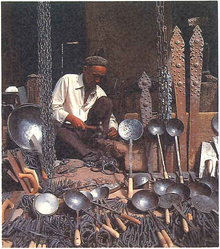
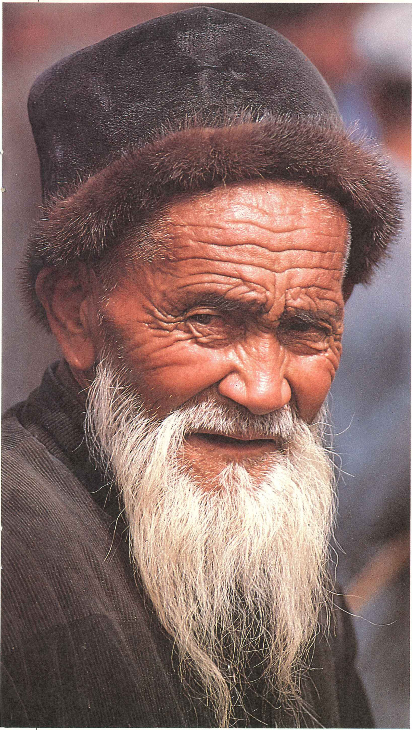
Once in the city we drove past the old Russian consulate, now a hotel, and were let off at the old British consulate, also a hotel. We were again struck by the paucity of ethnic Chinese, but here the people were mostly Uighur, although there were Kirghiz as well. Each group wears its distinctive headgear, so it is easy to tell which is which.
We were grubby, thirsty, and dog-tired. but we had made it, and proven that it could be done on a backpacker’s budget. We climbed aboard a horsedrawn “taxi” and searched out the 600-year-old Eidgar Mosque in the centre of the city. There were retreated into its calm and tranquility to contemplate and convince ourselves that we had really reached this fabled city across the roof of the world.
View the original scanned pages →
Originally published in bout de papier, Vol. 7, No. 1 (1989), pp. 22–25. Read the rest of this issue →